


plaine verte

jcm17
User
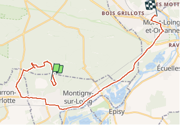

Length
16.3 km

Max alt
147 m

Uphill gradient
118 m
Km-Effort
18.2 km

Min alt
46 m

Downhill gradient
217 m
Boucle
No
Creation date :
2021-01-09 14:25:39.128
Updated on :
2021-01-09 16:12:09.783
1h27
Difficulty : Very easy

FREE GPS app for hiking
 SityTrail
IGN / Geographical institutes
SityTrail Plus
The world is yours!
About
Trail Walking of 16.3 km to be discovered at Ile-de-France, Seine-et-Marne, Montigny-sur-Loing. This trail is proposed by jcm17.
Positioning
Country:
France
Region :
Ile-de-France
Department/Province :
Seine-et-Marne
Municipality :
Montigny-sur-Loing
Location:
Unknown
Start:(Dec)
Start:(UTM)
480667 ; 5355054 (31U) N.
Comments