


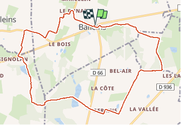
Baneins (12 km -D. 140 m)

Thomasdanielle
User

Length
12.3 km

Max alt
277 m

Uphill gradient
141 m
Km-Effort
14.2 km

Min alt
218 m

Downhill gradient
140 m
Boucle
Yes
Creation date :
2021-01-11 12:33:04.0
Updated on :
2021-01-11 16:35:42.755
2h57
Difficulty : Unknown

FREE GPS app for hiking
 SityTrail
IGN / Geographical institutes
SityTrail Plus
The world is yours!
About
Trail Walking of 12.3 km to be discovered at Auvergne-Rhône-Alpes, Ain, Baneins. This trail is proposed by Thomasdanielle.
Description
D/A parking de l'école au centre du village
Marche facile en campagne, sans difficulté
Positioning
Country:
France
Region :
Auvergne-Rhône-Alpes
Department/Province :
Ain
Municipality :
Baneins
Location:
Unknown
Start:(Dec)
Start:(UTM)
647016 ; 5108115 (31T) N.
Comments