


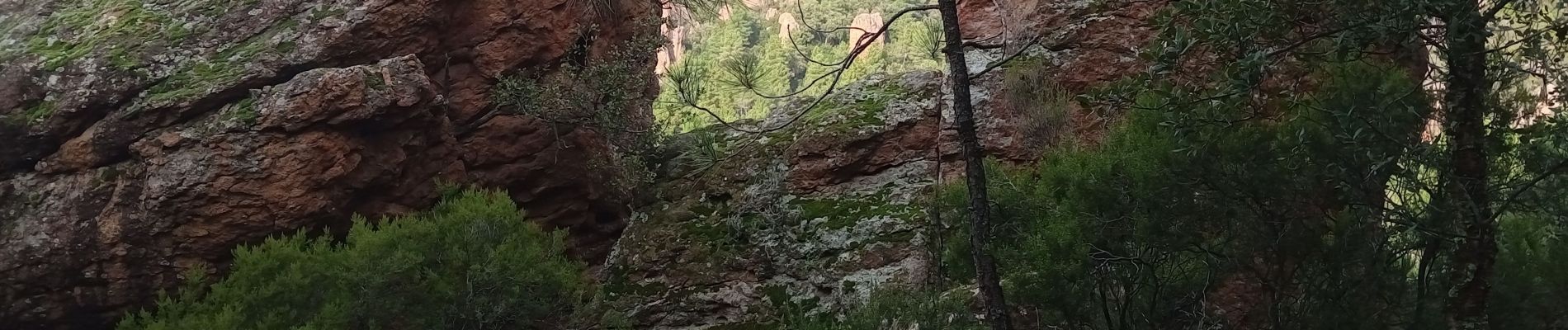
les gorges du blavet

vincente204
User
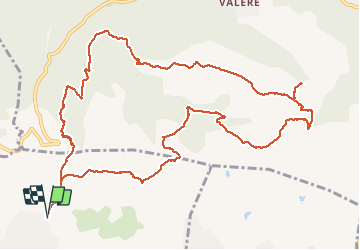

Length
14.9 km

Max alt
419 m

Uphill gradient
588 m
Km-Effort
23 km

Min alt
91 m

Downhill gradient
588 m
Boucle
Yes
Creation date :
2021-01-12 08:03:55.095
Updated on :
2021-01-12 13:45:33.096
5h40
Difficulty : Easy

FREE GPS app for hiking
 SityTrail
IGN / Geographical institutes
SityTrail Plus
The world is yours!
About
Trail Walking of 14.9 km to be discovered at Provence-Alpes-Côte d'Azur, Var, Roquebrune-sur-Argens. This trail is proposed by vincente204.
Description
facile
Photos


Positioning
Country:
France
Region :
Provence-Alpes-Côte d'Azur
Department/Province :
Var
Municipality :
Roquebrune-sur-Argens
Location:
Unknown
Start:(Dec)
Start:(UTM)
310189 ; 4819802 (32T) N.
Comments