


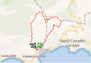
les hauts de Pramousquier

chrifor
User


5h52
Difficulty : Medium

FREE GPS app for hiking
 SityTrail
IGN / Geographical institutes
SityTrail Plus
The world is yours!
About
Trail Walking of 9.8 km to be discovered at Provence-Alpes-Côte d'Azur, Var, Le Lavandou. This trail is proposed by chrifor.
Description
Départ derrière l'hôtel beau site.
Très belles vues au cours de la rando; mer, îles et alpes enneigées...
Attention! peu après Biscarre, après avoir longé la maison, ne pas prendre le GR51 abandonné qui se perd (beaucoup de temps perdu!)
Continuer sur le joli chemin balisé jaune et bleu qui rejoint le GR un peu plus bas pour le quitter peu après.
Rando parcourue le 13/01/2021
Photos


Positioning
Comments