


Sonles

ritariri
User
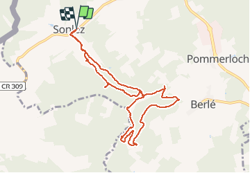

Length
9.1 km

Max alt
460 m

Uphill gradient
226 m
Km-Effort
12.1 km

Min alt
367 m

Downhill gradient
229 m
Boucle
Yes
Creation date :
2021-01-15 12:53:08.567
Updated on :
2021-01-15 16:09:49.663
3h14
Difficulty : Very easy

FREE GPS app for hiking
 SityTrail
IGN / Geographical institutes
SityTrail Plus
The world is yours!
About
Trail Walking of 9.1 km to be discovered at Unknown, Canton Wiltz, Winseler. This trail is proposed by ritariri.
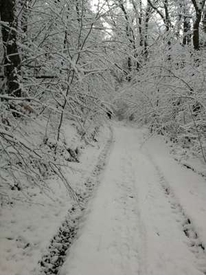
Photos


Positioning
Country:
Luxembourg
Region :
Unknown
Department/Province :
Canton Wiltz
Municipality :
Winseler
Location:
Unknown
Start:(Dec)
Start:(UTM)
702645 ; 5538507 (31U) N.
Comments