


Tête de faisan

nemolivier
User
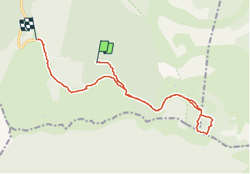

Length
9 km

Max alt
1724 m

Uphill gradient
315 m
Km-Effort
13.7 km

Min alt
1399 m

Downhill gradient
467 m
Boucle
No
Creation date :
2021-01-16 09:14:09.302
Updated on :
2021-01-16 14:25:43.027
2h34
Difficulty : Very easy

FREE GPS app for hiking
 SityTrail
IGN / Geographical institutes
SityTrail Plus
The world is yours!
About
Trail Touring skiing of 9 km to be discovered at Auvergne-Rhône-Alpes, Drôme, Saint-Agnan-en-Vercors. This trail is proposed by nemolivier.
Positioning
Country:
France
Region :
Auvergne-Rhône-Alpes
Department/Province :
Drôme
Municipality :
Saint-Agnan-en-Vercors
Location:
Unknown
Start:(Dec)
Start:(UTM)
692729 ; 4967899 (31T) N.
Comments