


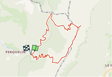
Dome et Piton de Bellefond par Perquelin

Evelyne et Francois
User

Length
10.7 km

Max alt
1953 m

Uphill gradient
919 m
Km-Effort
23 km

Min alt
1084 m

Downhill gradient
917 m
Boucle
Yes
Creation date :
2021-01-18 13:28:48.791
Updated on :
2021-01-18 13:34:35.259
5h00
Difficulty : Easy

FREE GPS app for hiking
 SityTrail
IGN / Geographical institutes
SityTrail Plus
The world is yours!
About
Trail On foot of 10.7 km to be discovered at Auvergne-Rhône-Alpes, Isère, Saint-Pierre-de-Chartreuse. This trail is proposed by Evelyne et Francois.
Description
boucle par le nord, dome et piton , puis retour par le sud
Positioning
Country:
France
Region :
Auvergne-Rhône-Alpes
Department/Province :
Isère
Municipality :
Saint-Pierre-de-Chartreuse
Location:
Unknown
Start:(Dec)
Start:(UTM)
723585 ; 5023627 (31T) N.
Comments