


Misteriou Valdingarde

MERMOZ33
User
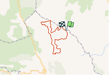

Length
14 km

Max alt
506 m

Uphill gradient
442 m
Km-Effort
19.9 km

Min alt
284 m

Downhill gradient
449 m
Boucle
Yes
Creation date :
2021-01-19 08:18:35.859
Updated on :
2021-01-19 14:40:23.671
6h19
Difficulty : Very easy

FREE GPS app for hiking
 SityTrail
IGN / Geographical institutes
SityTrail Plus
The world is yours!
About
Trail Walking of 14 km to be discovered at Provence-Alpes-Côte d'Azur, Var, Sainte-Maxime. This trail is proposed by MERMOZ33.
Description
super un peu physique malgres tout
Photos

Positioning
Country:
France
Region :
Provence-Alpes-Côte d'Azur
Department/Province :
Var
Municipality :
Sainte-Maxime
Location:
Unknown
Start:(Dec)
Start:(UTM)
307426 ; 4808423 (32T) N.
Comments