


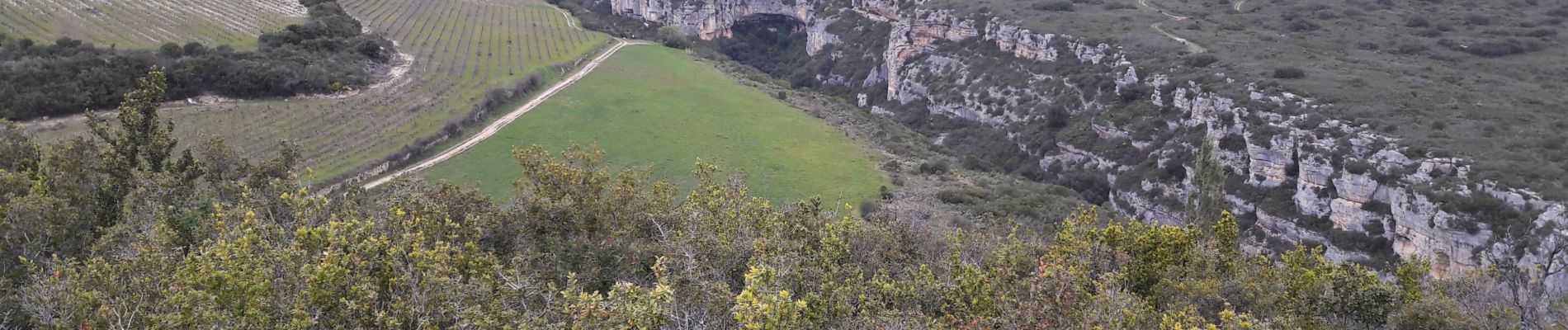
Grotte Aldène Cesseras

Ada11
User GUIDE
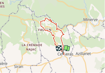

Length
12.6 km

Max alt
366 m

Uphill gradient
387 m
Km-Effort
17.8 km

Min alt
86 m

Downhill gradient
387 m
Boucle
Yes
Creation date :
2021-01-20 08:23:16.945
Updated on :
2021-02-26 18:45:04.469
3h10
Difficulty : Easy

FREE GPS app for hiking
 SityTrail
IGN / Geographical institutes
SityTrail Plus
The world is yours!
About
Trail Walking of 12.6 km to be discovered at Occitania, Hérault, Cesseras. This trail is proposed by Ada11.
Description
Très chouette. Descendre au moulin, visiter la grotte. Prendre le petit chemin à droite en contrebas de la falaise, entre le moulin et la grotte. Dans l'autre sens prendre le premier petit chemin à gauche.
Photos


Positioning
Country:
France
Region :
Occitania
Department/Province :
Hérault
Municipality :
Cesseras
Location:
Unknown
Start:(Dec)
Start:(UTM)
476781 ; 4796800 (31T) N.
Comments
Le top