


bourg doueil

ra2000
User
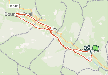

Length
10.8 km

Max alt
1353 m

Uphill gradient
262 m
Km-Effort
14.3 km

Min alt
1163 m

Downhill gradient
259 m
Boucle
Yes
Creation date :
2021-01-21 08:50:03.083
Updated on :
2021-01-21 20:09:16.757
5h30
Difficulty : Medium

FREE GPS app for hiking
 SityTrail
IGN / Geographical institutes
SityTrail Plus
The world is yours!
About
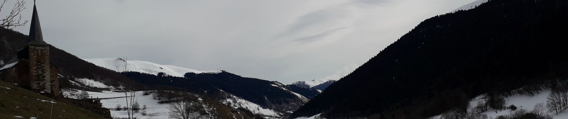
Trail Snowshoes of 10.8 km to be discovered at Occitania, Haute-Garonne, Mayrègne. This trail is proposed by ra2000.
Photos


Positioning
Country:
France
Region :
Occitania
Department/Province :
Haute-Garonne
Municipality :
Mayrègne
Location:
Unknown
Start:(Dec)
Start:(UTM)
298993 ; 4746199 (31T) N.
Comments