


la Planche ballon

PatriceCocuaud
User
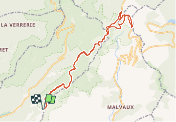

Length
20 km

Max alt
1172 m

Uphill gradient
564 m
Km-Effort
28 km

Min alt
946 m

Downhill gradient
566 m
Boucle
Yes
Creation date :
2021-01-24 11:24:54.296
Updated on :
2021-01-24 21:20:12.663
2h10
Difficulty : Very easy

FREE GPS app for hiking
 SityTrail
IGN / Geographical institutes
SityTrail Plus
The world is yours!
About
Trail Cross-country skiing of 20 km to be discovered at Bourgogne-Franche-Comté, Haute-Saône, Plancher-les-Mines. This trail is proposed by PatriceCocuaud.
Positioning
Country:
France
Region :
Bourgogne-Franche-Comté
Department/Province :
Haute-Saône
Municipality :
Plancher-les-Mines
Location:
Unknown
Start:(Dec)
Start:(UTM)
333634 ; 5293759 (32T) N.
Comments