


La Croix Valmer - Oppidum de Montjean

soca
User
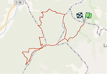

Length
12.8 km

Max alt
453 m

Uphill gradient
583 m
Km-Effort
21 km

Min alt
48 m

Downhill gradient
582 m
Boucle
Yes
Creation date :
2021-01-25 14:26:23.34
Updated on :
2021-01-25 14:29:54.455
4h40
Difficulty : Difficult

FREE GPS app for hiking
 SityTrail
IGN / Geographical institutes
SityTrail Plus
The world is yours!
About
Trail Walking of 12.8 km to be discovered at Provence-Alpes-Côte d'Azur, Var, Gassin. This trail is proposed by soca.
Description
Village de vacances Grafionier - piste des rochers - GR51 - Oppidum de Montjean - route forestière - piste du val d'Astier - retour piste de Baguier sud.
Positioning
Country:
France
Region :
Provence-Alpes-Côte d'Azur
Department/Province :
Var
Municipality :
Gassin
Location:
Unknown
Start:(Dec)
Start:(UTM)
300778 ; 4787945 (32T) N.
Comments