


13 Eguieres mt Menu reine Jeanne

Nathy8913
User

Length
11.5 km

Max alt
283 m

Uphill gradient
360 m
Km-Effort
16.3 km

Min alt
105 m

Downhill gradient
360 m
Boucle
Yes
Creation date :
2021-01-26 07:53:25.189
Updated on :
2021-01-26 14:19:54.751
5h59
Difficulty : Difficult

FREE GPS app for hiking
 SityTrail
IGN / Geographical institutes
SityTrail Plus
The world is yours!
About
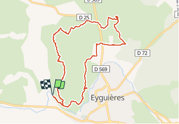
Trail Walking of 11.5 km to be discovered at Provence-Alpes-Côte d'Azur, Bouches-du-Rhône, Eyguières. This trail is proposed by Nathy8913.
Positioning
Country:
France
Region :
Provence-Alpes-Côte d'Azur
Department/Province :
Bouches-du-Rhône
Municipality :
Eyguières
Location:
Unknown
Start:(Dec)
Start:(UTM)
662030 ; 4840047 (31T) N.
Comments