


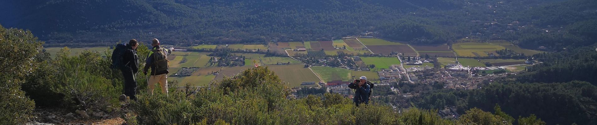
le mourre d'agnis par Signes

bernir
User
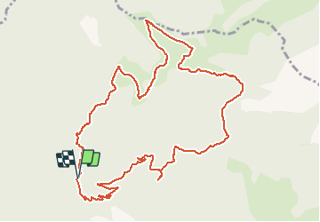

Length
13.8 km

Max alt
911 m

Uphill gradient
548 m
Km-Effort
21 km

Min alt
416 m

Downhill gradient
546 m
Boucle
Yes
Creation date :
2021-01-28 09:06:09.4
Updated on :
2021-01-30 10:52:50.903
5h53
Difficulty : Medium

FREE GPS app for hiking
 SityTrail
IGN / Geographical institutes
SityTrail Plus
The world is yours!
About
Trail Walking of 13.8 km to be discovered at Provence-Alpes-Côte d'Azur, Var, Signes. This trail is proposed by bernir.
Photos


Positioning
Country:
France
Region :
Provence-Alpes-Côte d'Azur
Department/Province :
Var
Municipality :
Signes
Location:
Unknown
Start:(Dec)
Start:(UTM)
731749 ; 4798343 (31T) N.
Comments