


samoens 5

yvesconnes
User

Length
2.3 km

Max alt
978 m

Uphill gradient
23 m
Km-Effort
3 km

Min alt
848 m

Downhill gradient
142 m
Boucle
No
Creation date :
2021-01-29 12:45:10.175
Updated on :
2021-01-29 13:22:56.464
36m
Difficulty : Very easy

FREE GPS app for hiking
 SityTrail
IGN / Geographical institutes
SityTrail Plus
The world is yours!
About
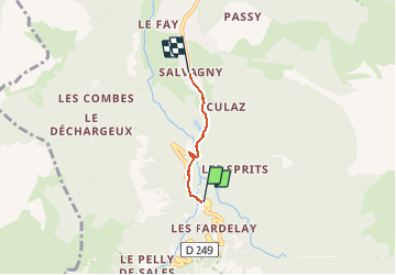
Trail Walking of 2.3 km to be discovered at Auvergne-Rhône-Alpes, Upper Savoy, Sixt-Fer-à-Cheval. This trail is proposed by yvesconnes.
Positioning
Country:
France
Region :
Auvergne-Rhône-Alpes
Department/Province :
Upper Savoy
Municipality :
Sixt-Fer-à-Cheval
Location:
Unknown
Start:(Dec)
Start:(UTM)
327651 ; 5099567 (32T) N.
Comments