


Les Opies et les crêtes du Mont Menu depuis Eyguières

Nathy8913
User
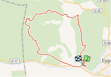

Length
10.2 km

Max alt
479 m

Uphill gradient
531 m
Km-Effort
17.3 km

Min alt
98 m

Downhill gradient
528 m
Boucle
Yes
Creation date :
2021-01-29 14:44:43.884
Updated on :
2021-01-29 14:44:43.884

FREE GPS app for hiking
 SityTrail
IGN / Geographical institutes
SityTrail Plus
The world is yours!
About
Trail of 10.2 km to be discovered at Provence-Alpes-Côte d'Azur, Bouches-du-Rhône, Eyguières. This trail is proposed by Nathy8913.
Points of interest


Positioning
Country:
France
Region :
Provence-Alpes-Côte d'Azur
Department/Province :
Bouches-du-Rhône
Municipality :
Eyguières
Location:
Unknown
Start:(Dec)
Start:(UTM)
662240 ; 4839774 (31T) N.
Comments