


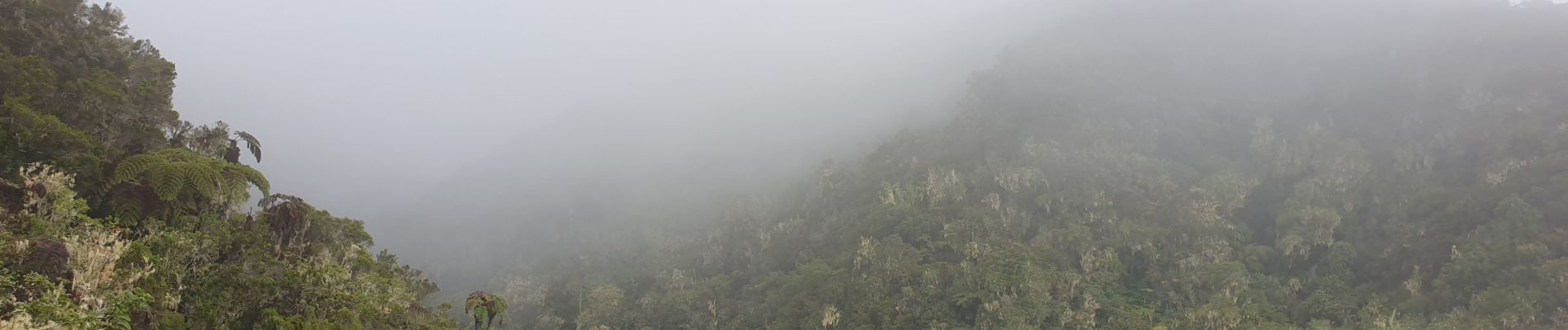
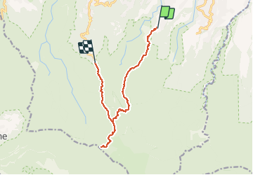
Piton BDN -Mamode Camp par le gîte de Roche Ecrite

lgmalherbe
User

Length
16.3 km

Max alt
1856 m

Uphill gradient
1215 m
Km-Effort
31 km

Min alt
724 m

Downhill gradient
726 m
Boucle
No
Creation date :
2021-01-30 03:14:02.583
Updated on :
2021-01-30 12:07:06.279
6h55
Difficulty : Difficult

FREE GPS app for hiking
 SityTrail
IGN / Geographical institutes
SityTrail Plus
The world is yours!
About
Trail Walking of 16.3 km to be discovered at Réunion, Unknown, Saint-Denis. This trail is proposed by lgmalherbe.
Photos


Positioning
Country:
France
Region :
Réunion
Department/Province :
Unknown
Municipality :
Saint-Denis
Location:
Unknown
Start:(Dec)
Start:(UTM)
340611 ; 7684186 (40K) S.
Comments