


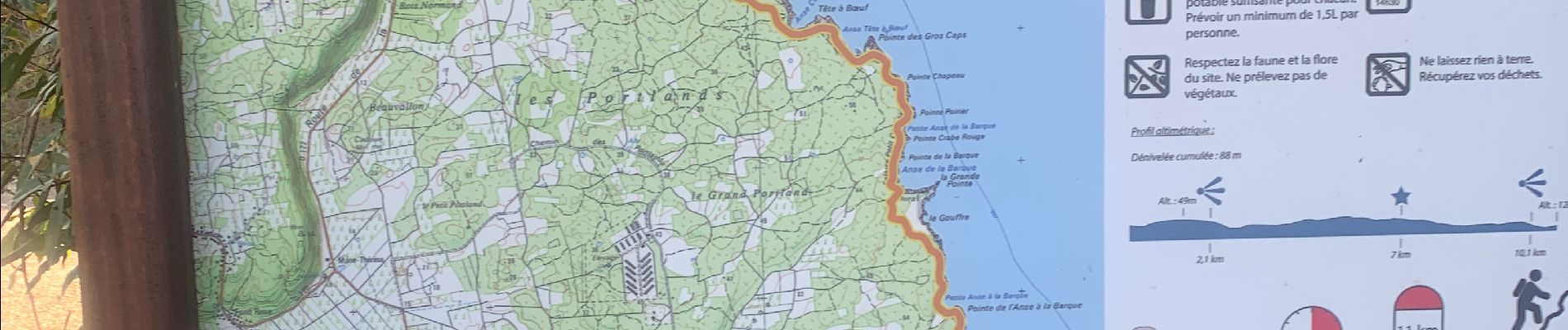
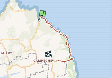
Porte d’enfer le littoral

sameja
User

Length
12.1 km

Max alt
58 m

Uphill gradient
217 m
Km-Effort
14.9 km

Min alt
0 m

Downhill gradient
188 m
Boucle
No
Creation date :
2021-01-30 11:09:52.0
Updated on :
2021-01-30 13:35:08.996
2h24
Difficulty : Difficult

FREE GPS app for hiking
 SityTrail
IGN / Geographical institutes
SityTrail Plus
The world is yours!
About
Trail Trail of 12.1 km to be discovered at Guadeloupe, Unknown, Anse-Bertrand. This trail is proposed by sameja.
Description
Trace des falaises la mahaudière
Photos


Positioning
Country:
France
Region :
Guadeloupe
Department/Province :
Unknown
Municipality :
Anse-Bertrand
Location:
Unknown
Start:(Dec)
Start:(UTM)
666254 ; 1823301 (20Q) N.
Comments