


les vans

oliviergau
User
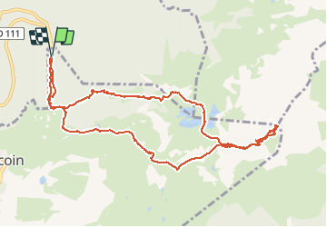

Length
11.5 km

Max alt
2433 m

Uphill gradient
1189 m
Km-Effort
27 km

Min alt
1408 m

Downhill gradient
1188 m
Boucle
Yes
Creation date :
2021-01-31 06:29:09.594
Updated on :
2021-01-31 12:51:39.959
3h10
Difficulty : Very easy

FREE GPS app for hiking
 SityTrail
IGN / Geographical institutes
SityTrail Plus
The world is yours!
About
Trail Touring skiing of 11.5 km to be discovered at Auvergne-Rhône-Alpes, Isère, Chamrousse. This trail is proposed by oliviergau.
Positioning
Country:
France
Region :
Auvergne-Rhône-Alpes
Department/Province :
Isère
Municipality :
Chamrousse
Location:
Unknown
Start:(Dec)
Start:(UTM)
727072 ; 5002564 (31T) N.
Comments