


Montagne de Brouis. Bargeme

GrouGary
User
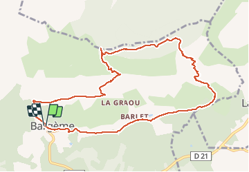

Length
11.7 km

Max alt
1465 m

Uphill gradient
576 m
Km-Effort
19.4 km

Min alt
935 m

Downhill gradient
581 m
Boucle
Yes
Creation date :
2021-01-31 07:50:48.067
Updated on :
2021-01-31 18:19:03.219
3h36
Difficulty : Easy

FREE GPS app for hiking
 SityTrail
IGN / Geographical institutes
SityTrail Plus
The world is yours!
About
Trail Walking of 11.7 km to be discovered at Provence-Alpes-Côte d'Azur, Var, Bargème. This trail is proposed by GrouGary.
Description
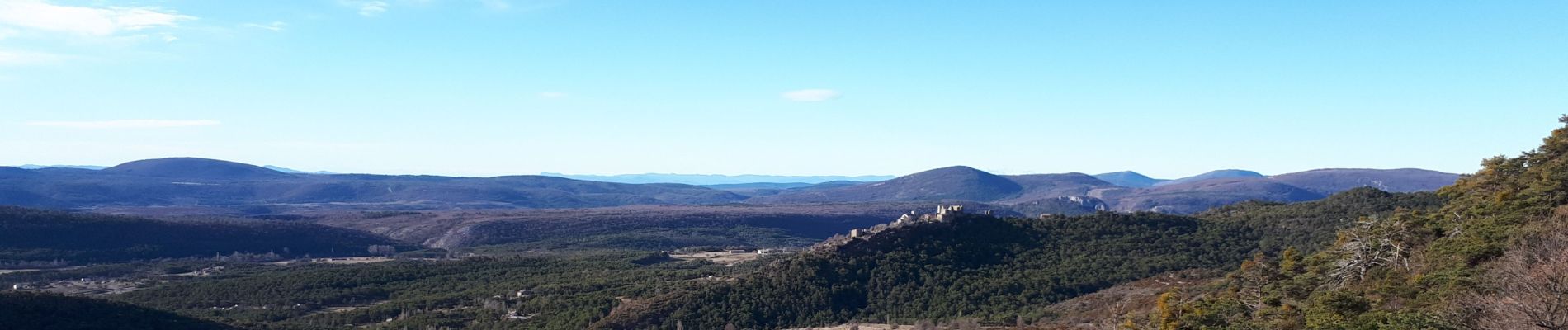
Belle boucle à faire de février à mai, sans aucune difficulté technique. En sous bois sur la montagne de Brouis.
Photos


Positioning
Country:
France
Region :
Provence-Alpes-Côte d'Azur
Department/Province :
Var
Municipality :
Bargème
Location:
Unknown
Start:(Dec)
Start:(UTM)
304380 ; 4844750 (32T) N.
Comments
Magnifique , vues superbes à la montée et à la descente . Les agréables odeurs , le calme .