


donchery.2021.01.31

trusgnachjf
User
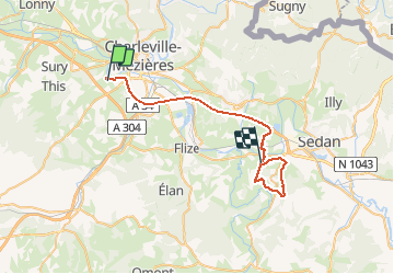

Length
53 km

Max alt
333 m

Uphill gradient
698 m
Km-Effort
62 km

Min alt
144 m

Downhill gradient
613 m
Boucle
No
Creation date :
2021-01-30 14:57:59.874
Updated on :
2021-01-31 16:10:18.6
18h37
Difficulty : Very easy

FREE GPS app for hiking
 SityTrail
IGN / Geographical institutes
SityTrail Plus
The world is yours!
About
Trail Walking of 53 km to be discovered at Grand Est, Ardennes, Prix-lès-Mézières. This trail is proposed by trusgnachjf.
Positioning
Country:
France
Region :
Grand Est
Department/Province :
Ardennes
Municipality :
Prix-lès-Mézières
Location:
Unknown
Start:(Dec)
Start:(UTM)
620808 ; 5512536 (31U) N.
Comments