


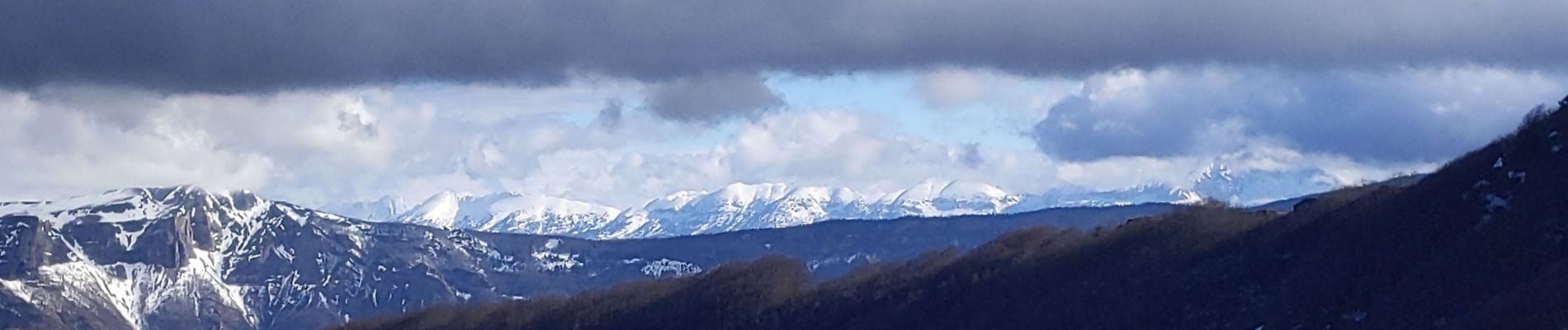
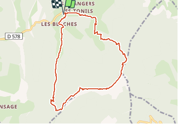
Bec pointu par les blaches

bymarc26
User

Length
9.8 km

Max alt
1317 m

Uphill gradient
742 m
Km-Effort
19.7 km

Min alt
645 m

Downhill gradient
743 m
Boucle
Yes
Creation date :
2021-02-03 08:13:54.959
Updated on :
2021-02-03 13:14:08.839
3h16
Difficulty : Difficult

FREE GPS app for hiking
 SityTrail
IGN / Geographical institutes
SityTrail Plus
The world is yours!
About
Trail Walking of 9.8 km to be discovered at Auvergne-Rhône-Alpes, Drôme, Omblèze. This trail is proposed by bymarc26.
Description
attention passage délicat avant col Bernard
Photos


Positioning
Country:
France
Region :
Auvergne-Rhône-Alpes
Department/Province :
Drôme
Municipality :
Omblèze
Location:
Unknown
Start:(Dec)
Start:(UTM)
675252 ; 4968915 (31T) N.
Comments