


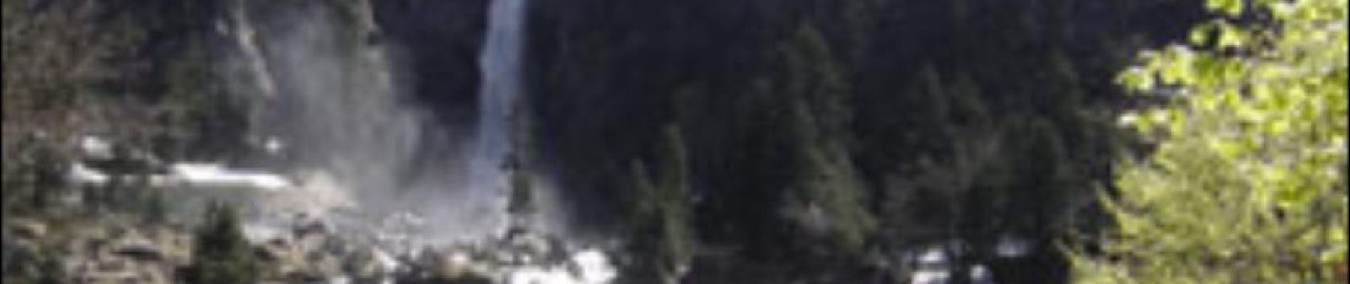
Cascade d'Ars et étang de Guzet

sga31
User
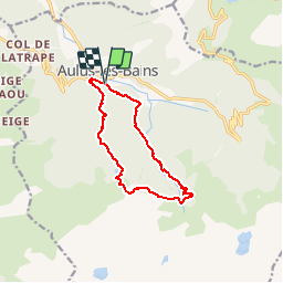

Length
11.3 km

Max alt
1592 m

Uphill gradient
844 m
Km-Effort
23 km

Min alt
773 m

Downhill gradient
842 m
Boucle
Yes
Creation date :
2014-12-10 00:00:00.0
Updated on :
2014-12-10 00:00:00.0
4h50
Difficulty : Medium

FREE GPS app for hiking
 SityTrail
IGN / Geographical institutes
SityTrail Plus
The world is yours!
About
Trail Walking of 11.3 km to be discovered at Occitania, Ariège, Aulus-les-Bains. This trail is proposed by sga31.
Photos


Positioning
Country:
France
Region :
Occitania
Department/Province :
Ariège
Municipality :
Aulus-les-Bains
Location:
Unknown
Start:(Dec)
Start:(UTM)
364093 ; 4738568 (31T) N.
Comments