


Hauts de Carnoux

jacques.seux
User

Length
9.7 km

Max alt
382 m

Uphill gradient
313 m
Km-Effort
13.9 km

Min alt
136 m

Downhill gradient
315 m
Boucle
Yes
Creation date :
2021-02-08 06:48:53.788
Updated on :
2021-02-08 06:50:08.971
3h09
Difficulty : Difficult

FREE GPS app for hiking
 SityTrail
IGN / Geographical institutes
SityTrail Plus
The world is yours!
About
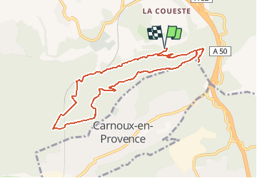
Trail Walking of 9.7 km to be discovered at Provence-Alpes-Côte d'Azur, Bouches-du-Rhône, Aubagne. This trail is proposed by jacques.seux.
Positioning
Country:
France
Region :
Provence-Alpes-Côte d'Azur
Department/Province :
Bouches-du-Rhône
Municipality :
Aubagne
Location:
Unknown
Start:(Dec)
Start:(UTM)
709003 ; 4794341 (31T) N.
Comments