


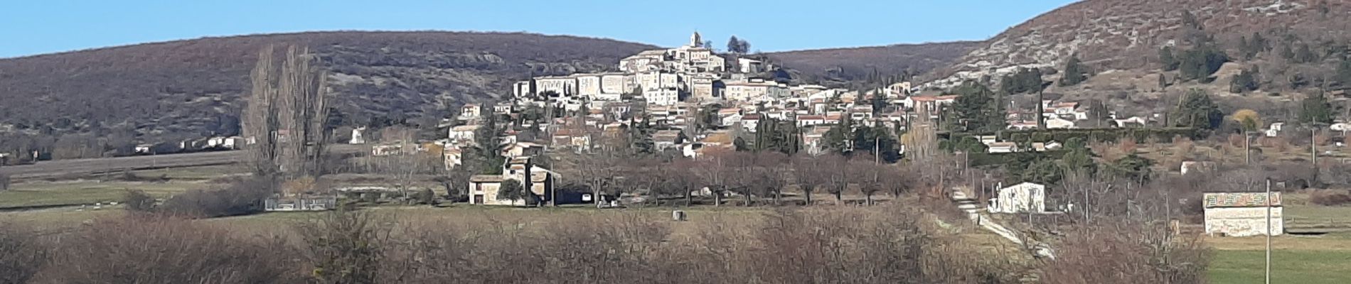
BANON Les Chastellas . Aven de Courtin . Hameau ruiné des Plaines n

RobinMicheline
User GUIDE
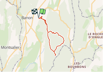

Length
12.4 km

Max alt
874 m

Uphill gradient
371 m
Km-Effort
17.3 km

Min alt
687 m

Downhill gradient
371 m
Boucle
Yes
Creation date :
2021-02-17 09:37:59.582
Updated on :
2021-02-17 17:09:43.881
3h33
Difficulty : Easy

FREE GPS app for hiking
 SityTrail
IGN / Geographical institutes
SityTrail Plus
The world is yours!
About
Trail Walking of 12.4 km to be discovered at Provence-Alpes-Côte d'Azur, Alpes-de-Haute-Provence, Banon. This trail is proposed by RobinMicheline.
Photos


Positioning
Country:
France
Region :
Provence-Alpes-Côte d'Azur
Department/Province :
Alpes-de-Haute-Provence
Municipality :
Banon
Location:
Unknown
Start:(Dec)
Start:(UTM)
711855 ; 4879470 (31T) N.
Comments