


Pierrefeu-la citadelle-17-02-21

Christiancordin
User
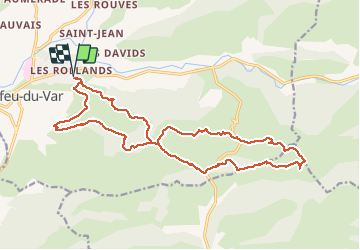

Length
22 km

Max alt
376 m

Uphill gradient
806 m
Km-Effort
32 km

Min alt
68 m

Downhill gradient
805 m
Boucle
Yes
Creation date :
2021-02-17 07:46:11.819
Updated on :
2021-02-23 15:52:55.21
6h36
Difficulty : Difficult

FREE GPS app for hiking
 SityTrail
IGN / Geographical institutes
SityTrail Plus
The world is yours!
About
Trail Walking of 22 km to be discovered at Provence-Alpes-Côte d'Azur, Var, Pierrefeu-du-Var. This trail is proposed by Christiancordin.
Description
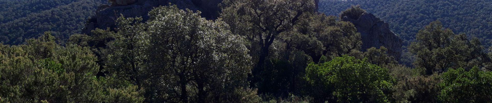
les Rolands-vallon de Beaussénas-baisse du Castellas-vallon de Gambet-vallon du temple-la citadelle-piste du camp Bourgas-piste du Chaumadou.
Photos


Positioning
Country:
France
Region :
Provence-Alpes-Côte d'Azur
Department/Province :
Var
Municipality :
Pierrefeu-du-Var
Location:
Unknown
Start:(Dec)
Start:(UTM)
269728 ; 4790484 (32T) N.
Comments