


col sanguiniere

oliviergau
User
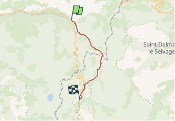

Length
15.2 km

Max alt
2592 m

Uphill gradient
836 m
Km-Effort
27 km

Min alt
1710 m

Downhill gradient
902 m
Boucle
No
Creation date :
2021-02-17 08:03:20.109
Updated on :
2021-02-17 18:20:53.408
3h56
Difficulty : Very easy

FREE GPS app for hiking
 SityTrail
IGN / Geographical institutes
SityTrail Plus
The world is yours!
About
Trail Touring skiing of 15.2 km to be discovered at Provence-Alpes-Côte d'Azur, Alpes-de-Haute-Provence, Uvernet-Fours. This trail is proposed by oliviergau.
Positioning
Country:
France
Region :
Provence-Alpes-Côte d'Azur
Department/Province :
Alpes-de-Haute-Provence
Municipality :
Uvernet-Fours
Location:
Unknown
Start:(Dec)
Start:(UTM)
319652 ; 4908999 (32T) N.
Comments