


st Benoît penne le sec

Joel26400
User

Length
22 km

Max alt
998 m

Uphill gradient
1041 m
Km-Effort
35 km

Min alt
348 m

Downhill gradient
1041 m
Boucle
Yes
Creation date :
2021-02-18 07:31:12.993
Updated on :
2021-02-19 07:20:13.512
6h12
Difficulty : Difficult

FREE GPS app for hiking
 SityTrail
IGN / Geographical institutes
SityTrail Plus
The world is yours!
About
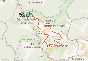
Trail Walking of 22 km to be discovered at Auvergne-Rhône-Alpes, Drôme, Saint-Benoit-en-Diois. This trail is proposed by Joel26400.
Description
très aérienne beaucoup de balcons
Positioning
Country:
France
Region :
Auvergne-Rhône-Alpes
Department/Province :
Drôme
Municipality :
Saint-Benoit-en-Diois
Location:
Unknown
Start:(Dec)
Start:(UTM)
680119 ; 4948072 (31T) N.
Comments