


PHR TM Day 14

ARVIEU
User
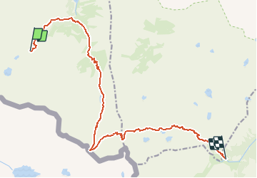

Length
17.4 km

Max alt
2708 m

Uphill gradient
1157 m
Km-Effort
33 km

Min alt
1566 m

Downhill gradient
1354 m
Boucle
No
Creation date :
2021-02-19 13:01:57.013
Updated on :
2021-02-19 13:04:19.066
7h36
Difficulty : Very difficult

FREE GPS app for hiking
 SityTrail
IGN / Geographical institutes
SityTrail Plus
The world is yours!
About
Trail Walking of 17.4 km to be discovered at Occitania, Hautespyrenees, Arrens-Marsous. This trail is proposed by ARVIEU.
Positioning
Country:
France
Region :
Occitania
Department/Province :
Hautespyrenees
Municipality :
Arrens-Marsous
Location:
Unknown
Start:(Dec)
Start:(UTM)
721486 ; 4748628 (30T) N.
Comments