


col de Giarlogue

oliviergau
User

Length
13.5 km

Max alt
2580 m

Uphill gradient
932 m
Km-Effort
26 km

Min alt
1665 m

Downhill gradient
932 m
Boucle
Yes
Creation date :
2021-02-19 06:58:24.904
Updated on :
2021-02-19 13:06:29.513
3h47
Difficulty : Very easy

FREE GPS app for hiking
 SityTrail
IGN / Geographical institutes
SityTrail Plus
The world is yours!
About
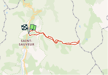
Trail Touring skiing of 13.5 km to be discovered at Provence-Alpes-Côte d'Azur, Maritime Alps, Entraunes. This trail is proposed by oliviergau.
Positioning
Country:
France
Region :
Provence-Alpes-Côte d'Azur
Department/Province :
Maritime Alps
Municipality :
Entraunes
Location:
Unknown
Start:(Dec)
Start:(UTM)
320418 ; 4899949 (32T) N.
Comments