


PHR TM Day 21

ARVIEU
User
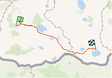

Length
10.7 km

Max alt
2880 m

Uphill gradient
1376 m
Km-Effort
26 km

Min alt
1688 m

Downhill gradient
498 m
Boucle
No
Creation date :
2021-02-19 16:02:01.717
Updated on :
2021-02-19 16:04:01.228
5h56
Difficulty : Very difficult

FREE GPS app for hiking
 SityTrail
IGN / Geographical institutes
SityTrail Plus
The world is yours!
About
Trail Walking of 10.7 km to be discovered at Occitania, Hautespyrenees, Loudenvielle. This trail is proposed by ARVIEU.
Positioning
Country:
France
Region :
Occitania
Department/Province :
Hautespyrenees
Municipality :
Loudenvielle
Location:
Loudenvielle
Start:(Dec)
Start:(UTM)
288748 ; 4733248 (31T) N.
Comments