


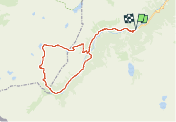
Circuit Embarrat Pourtet Nère

mitch1952
User

Length
22 km

Max alt
2432 m

Uphill gradient
1047 m
Km-Effort
36 km

Min alt
1464 m

Downhill gradient
1047 m
Boucle
Yes
Creation date :
2021-02-20 15:07:10.749
Updated on :
2022-06-08 08:52:31.493
8h08
Difficulty : Very difficult

FREE GPS app for hiking
 SityTrail
IGN / Geographical institutes
SityTrail Plus
The world is yours!
About
Trail Walking of 22 km to be discovered at Occitania, Hautespyrenees, Cauterets. This trail is proposed by mitch1952.
Description
Circuit très long mais d' une beauté exceptionnelle
Positioning
Country:
France
Region :
Occitania
Department/Province :
Hautespyrenees
Municipality :
Cauterets
Location:
Unknown
Start:(Dec)
Start:(UTM)
733998 ; 4748370 (30T) N.
Comments