


La Souriboise deppart Souribes 540 +

claude nier
User
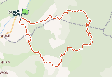

Length
12.9 km

Max alt
919 m

Uphill gradient
540 m
Km-Effort
20 km

Min alt
506 m

Downhill gradient
542 m
Boucle
Yes
Creation date :
2021-02-20 09:42:31.079
Updated on :
2021-02-20 20:01:37.619
4h25
Difficulty : Medium

FREE GPS app for hiking
 SityTrail
IGN / Geographical institutes
SityTrail Plus
The world is yours!
About
Trail Walking of 12.9 km to be discovered at Provence-Alpes-Côte d'Azur, Alpes-de-Haute-Provence, Sourribes. This trail is proposed by claude nier.
Description
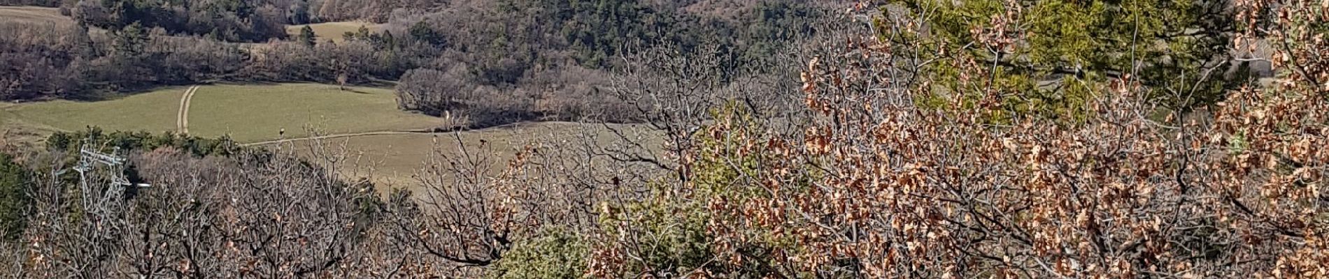
belle rando...des paysages sympas...
Photos


Positioning
Country:
France
Region :
Provence-Alpes-Côte d'Azur
Department/Province :
Alpes-de-Haute-Provence
Municipality :
Sourribes
Location:
Unknown
Start:(Dec)
Start:(UTM)
261394 ; 4892309 (32T) N.
Comments