


veyrier talabar

Louna
User

Length
11.3 km

Max alt
1169 m

Uphill gradient
792 m
Km-Effort
22 km

Min alt
447 m

Downhill gradient
804 m
Boucle
No
Creation date :
2021-02-21 08:48:23.955
Updated on :
2021-02-21 11:21:25.057
2h32
Difficulty : Very easy

FREE GPS app for hiking
 SityTrail
IGN / Geographical institutes
SityTrail Plus
The world is yours!
About
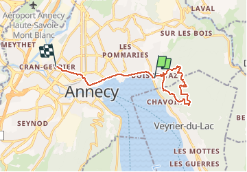
Trail Walking of 11.3 km to be discovered at Auvergne-Rhône-Alpes, Upper Savoy, Annecy. This trail is proposed by Louna .
Positioning
Country:
France
Region :
Auvergne-Rhône-Alpes
Department/Province :
Upper Savoy
Municipality :
Annecy
Location:
Annecy-le-Vieux
Start:(Dec)
Start:(UTM)
279752 ; 5087304 (32T) N.
Comments