


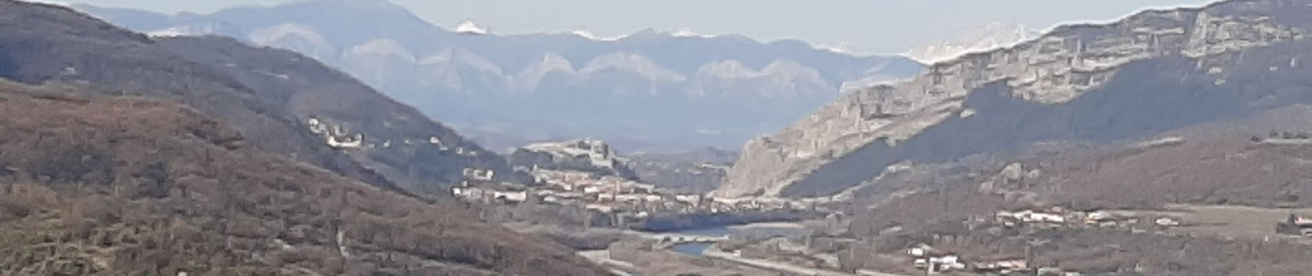
PEIPIN Aubignosc, le pas des Bœufs, a D , Ravin des Buis , les Roubines o n s

RobinMicheline
User GUIDE
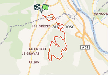

Length
9.6 km

Max alt
604 m

Uphill gradient
241 m
Km-Effort
12.8 km

Min alt
467 m

Downhill gradient
242 m
Boucle
Yes
Creation date :
2021-02-21 12:38:15.978
Updated on :
2021-02-21 15:42:03.977
2h31
Difficulty : Easy

FREE GPS app for hiking
 SityTrail
IGN / Geographical institutes
SityTrail Plus
The world is yours!
About
Trail Walking of 9.6 km to be discovered at Provence-Alpes-Côte d'Azur, Alpes-de-Haute-Provence, Peipin. This trail is proposed by RobinMicheline.
Photos

Positioning
Country:
France
Region :
Provence-Alpes-Côte d'Azur
Department/Province :
Alpes-de-Haute-Provence
Municipality :
Peipin
Location:
Unknown
Start:(Dec)
Start:(UTM)
736511 ; 4891073 (31T) N.
Comments