


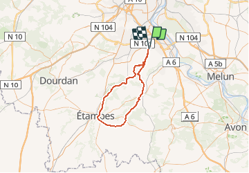
SityTrail - 5-80 Morigny FontainelaRivière 83 km

Lucquiaud
User

Length
70 km

Max alt
151 m

Uphill gradient
520 m
Km-Effort
77 km

Min alt
53 m

Downhill gradient
523 m
Boucle
Yes
Creation date :
2021-02-22 11:04:24.117
Updated on :
2021-02-22 11:12:37.369
5h30
Difficulty : Very difficult

FREE GPS app for hiking
 SityTrail
IGN / Geographical institutes
SityTrail Plus
The world is yours!
About
Trail Road bike of 70 km to be discovered at Ile-de-France, Essonne, Bondoufle. This trail is proposed by Lucquiaud.
Positioning
Country:
France
Region :
Ile-de-France
Department/Province :
Essonne
Municipality :
Bondoufle
Location:
Unknown
Start:(Dec)
Start:(UTM)
454187 ; 5384386 (31U) N.
Comments