


Bonnieux - le massif des cedres

mhetpierre
User

Length
6.1 km

Max alt
723 m

Uphill gradient
114 m
Km-Effort
7.6 km

Min alt
637 m

Downhill gradient
114 m
Boucle
Yes
Creation date :
2021-02-23 10:31:28.423
Updated on :
2021-02-23 10:32:46.299
--
Difficulty : Very easy

FREE GPS app for hiking
 SityTrail
IGN / Geographical institutes
SityTrail Plus
The world is yours!
About
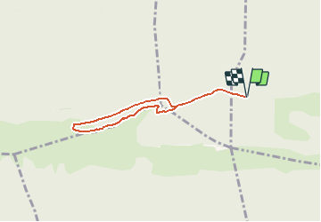
Trail On foot of 6.1 km to be discovered at Provence-Alpes-Côte d'Azur, Vaucluse, Bonnieux. This trail is proposed by mhetpierre.
Positioning
Country:
France
Region :
Provence-Alpes-Côte d'Azur
Department/Province :
Vaucluse
Municipality :
Bonnieux
Location:
Unknown
Start:(Dec)
Start:(UTM)
682863 ; 4852188 (31T) N.
Comments