


Com de Fontouse

Sorriaux
User

Length
8.6 km

Max alt
2303 m

Uphill gradient
747 m
Km-Effort
18.6 km

Min alt
1553 m

Downhill gradient
746 m
Boucle
Yes
Creation date :
2021-02-23 08:25:08.186
Updated on :
2021-02-23 15:54:41.688
3h26
Difficulty : Difficult

FREE GPS app for hiking
 SityTrail
IGN / Geographical institutes
SityTrail Plus
The world is yours!
About
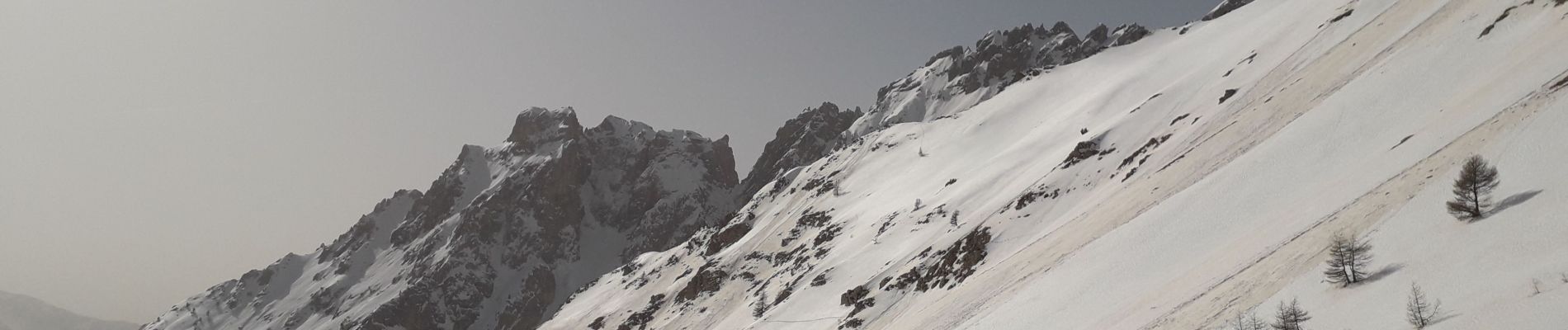
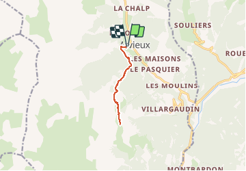
Trail Walking of 8.6 km to be discovered at Provence-Alpes-Côte d'Azur, Hautes-Alpes, Arvieux. This trail is proposed by Sorriaux.
Description
Difficile
Photos


Positioning
Country:
France
Region :
Provence-Alpes-Côte d'Azur
Department/Province :
Hautes-Alpes
Municipality :
Arvieux
Location:
Unknown
Start:(Dec)
Start:(UTM)
320817 ; 4959616 (32T) N.
Comments