


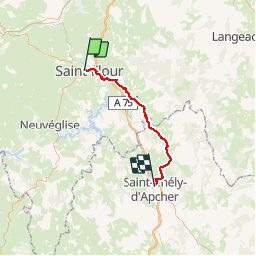
st flour-st chely

frank12
User

Length
49 km

Max alt
1090 m

Uphill gradient
1308 m
Km-Effort
65 km

Min alt
753 m

Downhill gradient
1109 m
Boucle
No
Creation date :
2014-12-10 00:00:00.0
Updated on :
2014-12-10 00:00:00.0
2h00
Difficulty : Unknown

FREE GPS app for hiking
 SityTrail
IGN / Geographical institutes
SityTrail Plus
The world is yours!
About
Trail Other activity of 49 km to be discovered at Auvergne-Rhône-Alpes, Cantal, Saint-Flour. This trail is proposed by frank12.
Positioning
Country:
France
Region :
Auvergne-Rhône-Alpes
Department/Province :
Cantal
Municipality :
Saint-Flour
Location:
Unknown
Start:(Dec)
Start:(UTM)
506299 ; 4986424 (31T) N.
Comments