


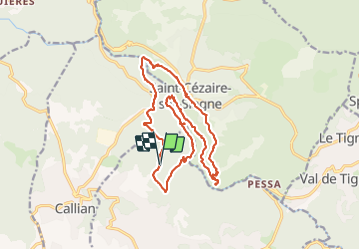
Gorges de la Siagne

ETMU5496
User


4h21
Difficulty : Medium

FREE GPS app for hiking
 SityTrail
IGN / Geographical institutes
SityTrail Plus
The world is yours!
About
Trail Walking of 19.4 km to be discovered at Provence-Alpes-Côte d'Azur, Var, Montauroux. This trail is proposed by ETMU5496.
Description
Au départ du stade municipal de Montauroux.
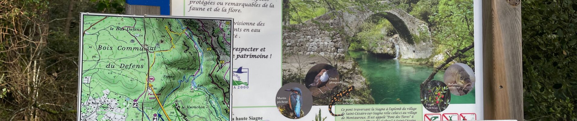
Belle randonnée le long de la Siagne d'une jolie couleur émeraude aux abords de St Cézaire. Du dénivelé parfois exigeant mais de très beaux points de vue en perspective. Pique nique à St Cézaire pour profiter de ce joli village perché et d'un beau point de vue sur les gorges de la Siagne.
Rando à réaliser en fin d'hiver pour profiter de la puissance des eaux.
ibp=81
Photos


27 photos in total. Please click on a photo to see them all in the gallery.
Positioning
Comments