


moto cross

Jacky Fumey
User
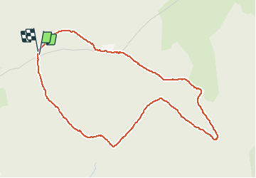

Length
5.1 km

Max alt
522 m

Uphill gradient
131 m
Km-Effort
6.8 km

Min alt
415 m

Downhill gradient
134 m
Boucle
Yes
Creation date :
2021-02-24 13:14:03.372
Updated on :
2021-02-24 15:02:59.408
1h48
Difficulty : Easy

FREE GPS app for hiking
 SityTrail
IGN / Geographical institutes
SityTrail Plus
The world is yours!
About
Trail Walking of 5.1 km to be discovered at Auvergne-Rhône-Alpes, Ain, Ambérieu-en-Bugey. This trail is proposed by Jacky Fumey.
Positioning
Country:
France
Region :
Auvergne-Rhône-Alpes
Department/Province :
Ain
Municipality :
Ambérieu-en-Bugey
Location:
Unknown
Start:(Dec)
Start:(UTM)
684401 ; 5092999 (31T) N.
Comments