


COL DE LA MORENO

walrou63
User
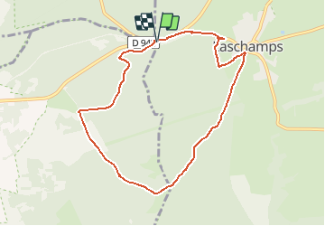

Length
8.5 km

Max alt
1125 m

Uphill gradient
248 m
Km-Effort
11.8 km

Min alt
985 m

Downhill gradient
250 m
Boucle
Yes
Creation date :
2021-02-24 17:45:27.152
Updated on :
2021-03-31 09:51:32.739
2h10
Difficulty : Easy

FREE GPS app for hiking
 SityTrail
IGN / Geographical institutes
SityTrail Plus
The world is yours!
About
Trail On foot of 8.5 km to be discovered at Auvergne-Rhône-Alpes, Puy-de-Dôme, Nébouzat. This trail is proposed by walrou63.
Positioning
Country:
France
Region :
Auvergne-Rhône-Alpes
Department/Province :
Puy-de-Dôme
Municipality :
Nébouzat
Location:
Unknown
Start:(Dec)
Start:(UTM)
496065 ; 5065307 (31T) N.
Comments