Trail Walking Plan-d'Aups-Sainte-Baume - RB-plan_daups-gemenos - Photo
© OpenStreetMap contributors
Length
Length
11.3 km
Max alt
Max alt
874 m
Uphill gradient
Uphill gradient
236 m
Km-Effort
Km-Effort  
16.3 km
Min alt
Min alt
147 m
Downhill gradient
Downhill gradient
778 m
Boucle
Boucle
No
Creation date :
2014-12-10 00:00:00.0
Updated on :
2014-12-10 00:00:00.0

(0 Reviews)

Walking
Walking
3h09
Difficulty : Medium

Scan this QR Code to open this trail in the SityTrail application

FREE GPS app for hiking

Logo SityTrail SityTrail

IGN / Geographical institutes

Download SityTrail from the App Store Download SityTrail from Google Play

Logo SityTrail SityTrail Plus

The world is yours!

Download SityTrail from the App Store Download SityTrail from Google Play Download SityTrail on Huawei AppGallery

About

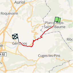
Trail Walking of 11.3 km to be discovered at Provence-Alpes-Côte d'Azur, Var, Plan-d'Aups-Sainte-Baume. This trail is proposed by raymondfn.

Description

Plan d'Aups, la Brasque, col de Bertagne, la Glacière, le Vallon des Crides, le Vallon du Fauge, remarquer le "Trou du vent" en haut de la falaise à votre gauche, A-R possible au Gour de l'Oule, ancienne abbaye cistercienne, le parc de Saint Pons, chapelle Saint-Martin, Gemenos

Elevation profile

Positioning

Country:
France
Region :
Provence-Alpes-Côte d'Azur
Department/Province :
Var
Municipality :
Plan-d'Aups-Sainte-Baume
Location:
Unknown
Start:(UTM)
719902 ; 4800657 (31T) N.


Close
My subscriptions