


cabane ours

doumeherve
User
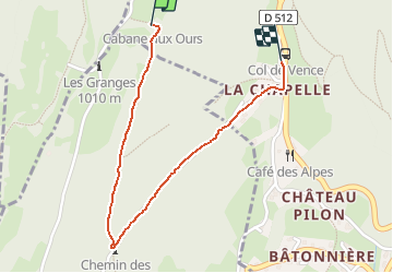

Length
1.6 km

Max alt
1009 m

Uphill gradient
4 m
Km-Effort
2.4 km

Min alt
764 m

Downhill gradient
234 m
Boucle
No
Creation date :
2021-03-02 12:11:18.924
Updated on :
2021-03-02 12:44:16.635
26m
Difficulty : Very easy

FREE GPS app for hiking
 SityTrail
IGN / Geographical institutes
SityTrail Plus
The world is yours!
About
Trail Walking of 1.6 km to be discovered at Auvergne-Rhône-Alpes, Isère, Corenc. This trail is proposed by doumeherve.
Description
très facile
Positioning
Country:
France
Region :
Auvergne-Rhône-Alpes
Department/Province :
Isère
Municipality :
Corenc
Location:
Unknown
Start:(Dec)
Start:(UTM)
715524 ; 5012724 (31T) N.
Comments