


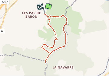
Cuers .la bouisse , le roucas de mounier

GILOU440
User

Length
7.9 km

Max alt
263 m

Uphill gradient
308 m
Km-Effort
12.1 km

Min alt
114 m

Downhill gradient
308 m
Boucle
Yes
Creation date :
2021-03-02 09:41:02.416
Updated on :
2021-03-02 15:52:28.379
3h13
Difficulty : Easy

FREE GPS app for hiking
 SityTrail
IGN / Geographical institutes
SityTrail Plus
The world is yours!
About
Trail Walking of 7.9 km to be discovered at Provence-Alpes-Côte d'Azur, Var, Cuers. This trail is proposed by GILOU440.
Photos


Positioning
Country:
France
Region :
Provence-Alpes-Côte d'Azur
Department/Province :
Var
Municipality :
Cuers
Location:
Unknown
Start:(Dec)
Start:(UTM)
263894 ; 4789167 (32T) N.
Comments