


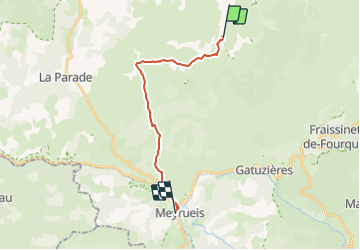
Chemin de St-Guilhem - étape 07 : Hures - Meyrueis

cathel11
User

Length
16.1 km

Max alt
1042 m

Uphill gradient
285 m
Km-Effort
21 km

Min alt
699 m

Downhill gradient
535 m
Boucle
No
Creation date :
2021-03-03 12:10:55.108
Updated on :
2022-01-16 19:33:20.247
4h42
Difficulty : Very difficult

FREE GPS app for hiking
 SityTrail
IGN / Geographical institutes
SityTrail Plus
The world is yours!
About
Trail Walking of 16.1 km to be discovered at Occitania, Lozère, Hures-la-Parade. This trail is proposed by cathel11.
Positioning
Country:
France
Region :
Occitania
Department/Province :
Lozère
Municipality :
Hures-la-Parade
Location:
Unknown
Start:(Dec)
Start:(UTM)
536774 ; 4901350 (31T) N.
Comments