


Lambesc - la Font d'Arles

mhetpierre
User
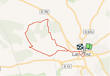

Length
8.2 km

Max alt
237 m

Uphill gradient
107 m
Km-Effort
9.6 km

Min alt
167 m

Downhill gradient
104 m
Boucle
Yes
Creation date :
2021-03-03 19:27:58.845
Updated on :
2021-03-03 19:28:54.969
--
Difficulty : Very easy

FREE GPS app for hiking
 SityTrail
IGN / Geographical institutes
SityTrail Plus
The world is yours!
About
Trail On foot of 8.2 km to be discovered at Provence-Alpes-Côte d'Azur, Bouches-du-Rhône, Lambesc. This trail is proposed by mhetpierre.
Positioning
Country:
France
Region :
Provence-Alpes-Côte d'Azur
Department/Province :
Bouches-du-Rhône
Municipality :
Lambesc
Location:
Unknown
Start:(Dec)
Start:(UTM)
682548 ; 4835995 (31T) N.
Comments