


la lieutenante par la Bouvrie

gillou1947
User
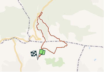

Length
7.6 km

Max alt
270 m

Uphill gradient
228 m
Km-Effort
10.7 km

Min alt
90 m

Downhill gradient
226 m
Boucle
Yes
Creation date :
2021-03-05 07:58:40.878
Updated on :
2021-03-05 10:09:09.784
2h09
Difficulty : Very easy

FREE GPS app for hiking
 SityTrail
IGN / Geographical institutes
SityTrail Plus
The world is yours!
About
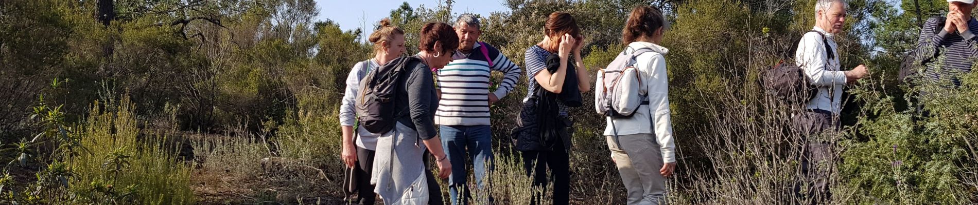
Trail Walking of 7.6 km to be discovered at Provence-Alpes-Côte d'Azur, Var, Roquebrune-sur-Argens. This trail is proposed by gillou1947.
Photos


Positioning
Country:
France
Region :
Provence-Alpes-Côte d'Azur
Department/Province :
Var
Municipality :
Roquebrune-sur-Argens
Location:
Unknown
Start:(Dec)
Start:(UTM)
310226 ; 4819894 (32T) N.
Comments