


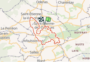
Saint- Étienne-des-Ouillières (15 km-D. 219 m)

Thomasdanielle
User

Length
15.1 km

Max alt
340 m

Uphill gradient
219 m
Km-Effort
18 km

Min alt
218 m

Downhill gradient
219 m
Boucle
Yes
Creation date :
2021-03-07 09:31:44.0
Updated on :
2021-03-11 15:26:12.442
4h29
Difficulty : Very easy

FREE GPS app for hiking
 SityTrail
IGN / Geographical institutes
SityTrail Plus
The world is yours!
About
Trail Walking of 15.1 km to be discovered at Auvergne-Rhône-Alpes, Rhône, Saint-Étienne-des-Oullières. This trail is proposed by Thomasdanielle.
Description
Parking rue du tacot
Positioning
Country:
France
Region :
Auvergne-Rhône-Alpes
Department/Province :
Rhône
Municipality :
Saint-Étienne-des-Oullières
Location:
Unknown
Start:(Dec)
Start:(UTM)
627612 ; 5102764 (31T) N.
Comments