


z ubac des cabrans 09-03-21

cb8310
User
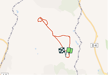

Length
6.5 km

Max alt
75 m

Uphill gradient
81 m
Km-Effort
7.6 km

Min alt
37 m

Downhill gradient
80 m
Boucle
Yes
Creation date :
2021-03-09 12:31:19.955
Updated on :
2021-03-10 07:40:08.483
2h03
Difficulty : Easy

FREE GPS app for hiking
 SityTrail
IGN / Geographical institutes
SityTrail Plus
The world is yours!
About
Trail Walking of 6.5 km to be discovered at Provence-Alpes-Côte d'Azur, Var, Puget-sur-Argens. This trail is proposed by cb8310.
Description
rando sans difficultés si ce n'est un chemin existant sur la carte IGN mais inexistant en réalité

Positioning
Country:
France
Region :
Provence-Alpes-Côte d'Azur
Department/Province :
Var
Municipality :
Puget-sur-Argens
Location:
Unknown
Start:(Dec)
Start:(UTM)
313861 ; 4816126 (32T) N.
Comments